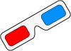
Here are samples of anaglyphs of aerial photograph, contour map and shaded relief image from digital elevation data. They will show you how three-dimensional shape of topography is expressed with anaglyph technology.
Here are anaglyphs of some interesting topography in Japan. As teaching / studying materials for geography, you can freely download them.