Stereoscopy of Topography with Anaglyph Technology
Examples of Anaglyph on Topography
Here are samples of anaglyphs of aerial photograph, contour map and shaded relief image from digital elevation data. They will show you how three-dimensional shape of topography is expressed with anaglyph technology.
 You need red-blue (red-cyan) glasses to see anaglyph images.
For your eyes, please do not continue to look at anaglyph for long time.
- Aerial Photograph
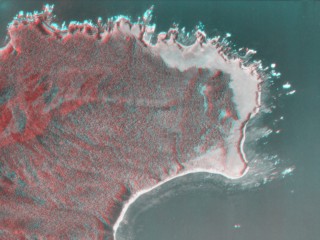
- (Click here or the image to enlarge the image)
- Shiretoko Cape, Hokkaido, Japan
- Source: Aerial Photographs HO-73-11Y C4-1,2 by Geographical Survey Institute, Japan *
- Satellite Image
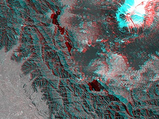
- (Click here or the image to see large images and a commentary)
- South part of Yamanashi (around Mt. Fuji), Central Honshu, Japan
- Source: Image data acquired by the PRISM sensor onboard the Satellite "Daichi"
- Courtesy of JAXA
- Shaded Relief from digital elevation data
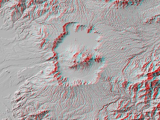
- (Click here or the image to enlarge the image)
- Aso Caldera, Kyushu, Japan
- Source: "Digital Map 50m Grid (Elevation) NIPPON-III" by Geographical Survey Institute, Japan *
- Contour Map
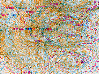
- (Click here or the image to enlarge the image)
- A part of "RB-Map : Myoko-zan and Togakushi-yama - the pop-up topographic map of mountains" by Act-on.
- Act-on (a company in Japan) published the "RB-Map" series. Act-on is closed down now.
Another anaglyph map is served by the Geographical Survey Institute, Japan. The GSI serves "Watchizu Stereoscopy System" on the internet. You can look at anaglyph of a small part of 1:25000 Topographic Map of any area in Japan.- Bird's-eye view from an airplane
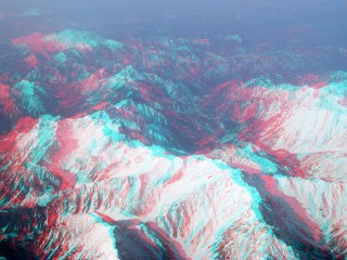
- (Click here or the image to enlarge the image)
- Hida Mountains, Central Honshu, Japan
- Source: photographs taken by M. Nagaoka
* Aerial photographs on this web site are reproduction of the aerial photographs taken by the Geographical Survey Institute, Japan with approval of the director general of GSI. (Approval Number: H17-so-fuku No.392)
Maps (Shaded relief images) on this web site are created from Digital Map 50m Grid (Elevation) published by the Geographical Survey Institute, Japan with approval of the director general of GSI. (Approval Number: H17-so-shi No.332)
Back
 You need red-blue (red-cyan) glasses to see anaglyph images.
 You need red-blue (red-cyan) glasses to see anaglyph images.


