Stereoscopy of Topography with Anaglyph Technology
Anaglyph images of Topography for Geographical Education
 |
Tokyo
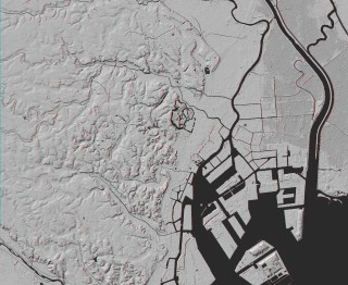
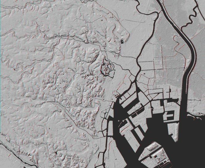
Shaded Relief Image (Anaglyph)
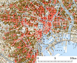
Corresponding Map
Laid-out sheet for print (Shaded Relief Image and Map)
Notes
- Digital Elevation Data:
- "Digital Map 5m Grid (Elevation) The 23-ward area of Tokyo Metropolis" by GSI
- "Digital Map 50m Grid (Elevation) NIPPON-II" by GSI
- Map:
- 1:200,000 Regional Map "Tokyo" by GSI (August 2005)
- Location:
- Tokyo (the 23-ward area)
- Topic on Topography:
- Pleistocene Upland, Alluvial Lowland
|
Here are anaglyphs of some interesting topography in Japan. As teaching / studying materials for geography, you can freely download them, but use for other purpose except education is prohibited.
Service of some high-resolution images on the web are now suspended because of disk space of the server.
 You need red-blue (red-cyan) glasses to see anaglyph images.
- * NOTICE *
- For your eyes, please do not continue to look at anaglyph for long time.
When a teacher uses anaglyph in his class, he should cares about health of students.
- Credits
- Maps on this web site are reproduction of 1:200,000 Regional Map published by the Geographical Survey Institute, Japan with approval of the director general of GSI. (Approval Number: H17-so-fuku No.392)
- Maps (shaded relief images) on this web site are created from "Digital Map 5m Grid (Elevation)" and "Digital Map 50m Grid (Elevation)" published by the Geographical Survey Institute, Japan with approval of the director general of GSI. (Approval Number: H17-so-shi No.332)
