Stereoscopy of Topography with Anaglyph Technology
Anaglyph images of Topography for Geographical Education
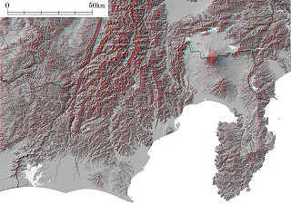 |
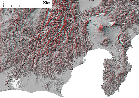
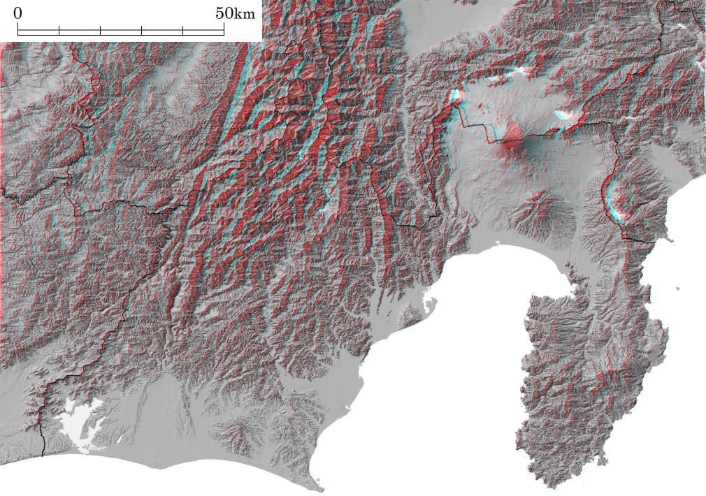
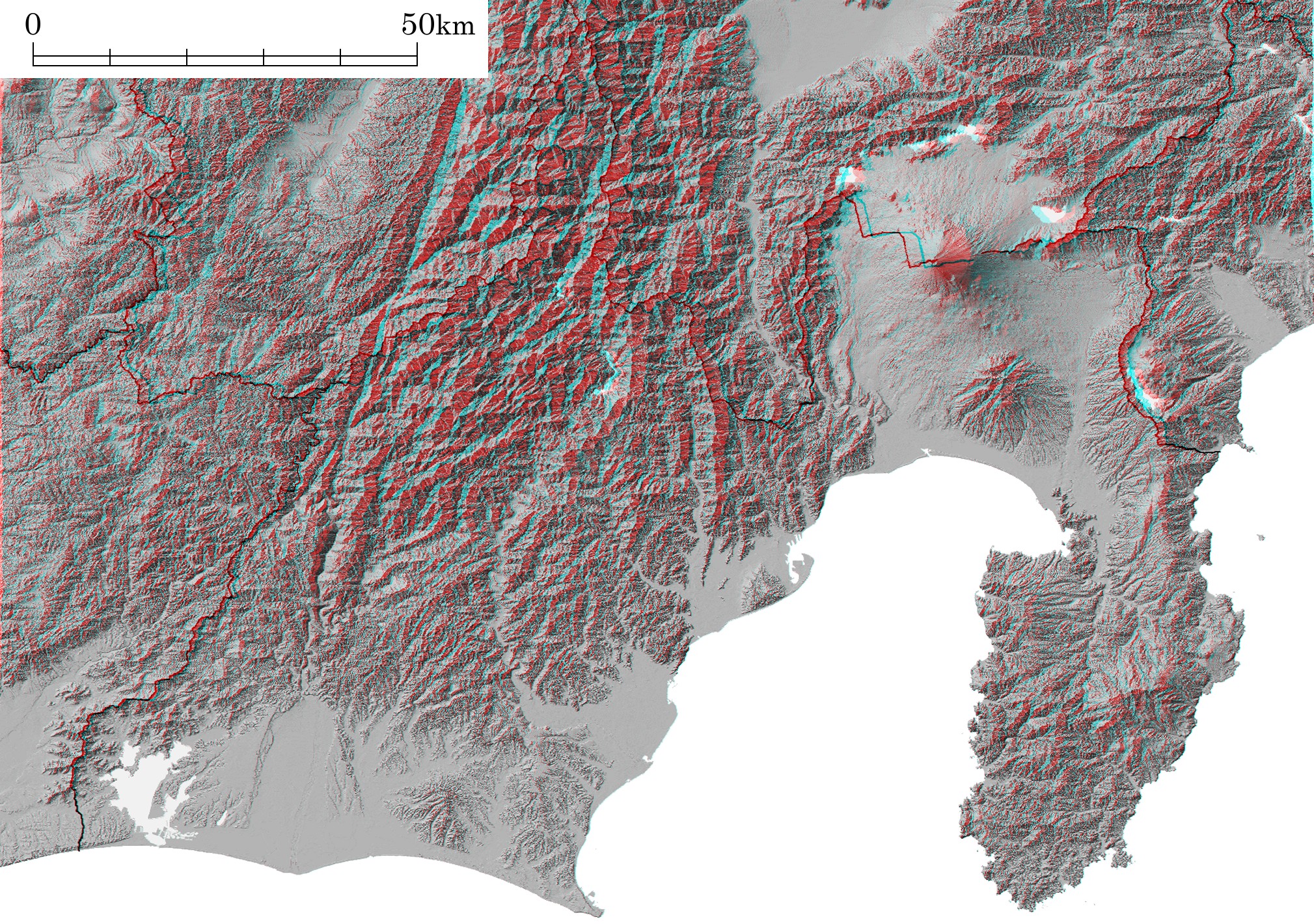
Shizuoka Prefecture
Shaded Relief Image (Anaglyph)
Laid-out sheet for print
Notes
- Digital Elevation Data:
- "Digital Map 50m Grid (Elevation) NIPPON-II" by GSI
- Digital Map Data on Prefecural Boundary:
- "JMC Map (Map Image)" by Japan Map Center
- Location:
- Shizuoka, Central Honshu
- Topic on Topography:
- Mt. Fuji, Izu Peninsula, Akaishi Mountains
|
Here are anaglyphs of some interesting topography in Japan. As teaching / studying materials for geography, you can freely download them, but use for other purpose except education is prohibited.
 You need red-blue (red-cyan) glasses to see anaglyph images.
- * NOTICE *
- For your eyes, please do not continue to look at anaglyph for long time.
When a teacher uses anaglyph in his class, he should cares about health of students.
- Credits
- Maps (shaded relief images) on this web site are created from "Digital Map 50m Grid (Elevation)" published by the Geographical Survey Institute, Japan with approval of the director general of GSI. (Approval Number: H17-so-shi No.332)
- "JMC Map (Japan)" published by the Japan Map Center is also used for the maps (shaded relief images) on this web site with approval of the JMC.
