Stereoscopy of Topography with Anaglyph Technology
Anaglyph images of Topography for Geographical Education
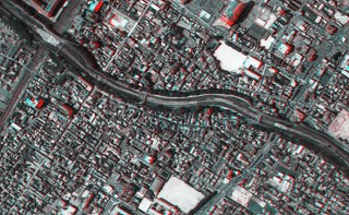 |
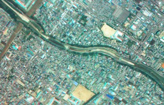
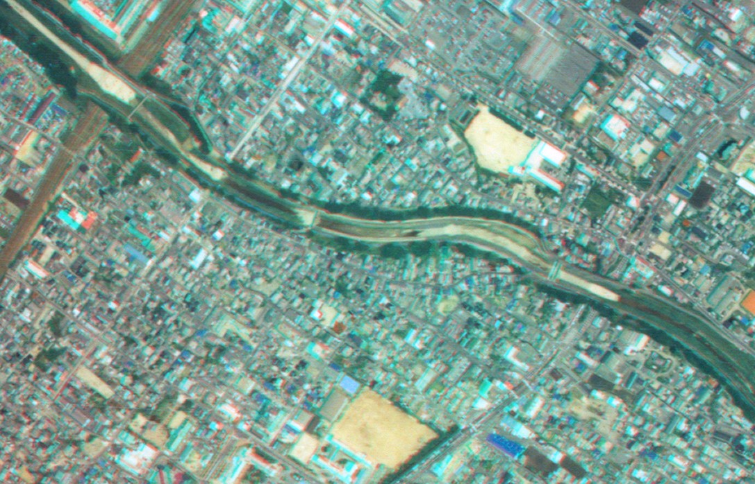
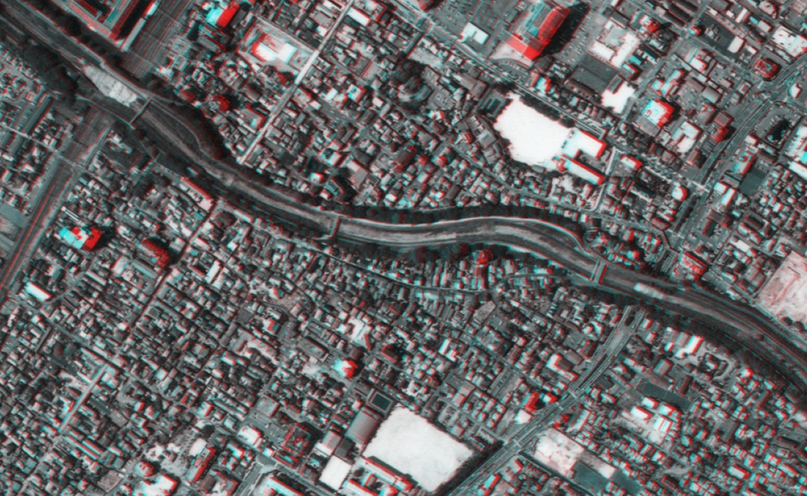
Kusatsu River (2)
Aerial Photograph (Anaglyph)
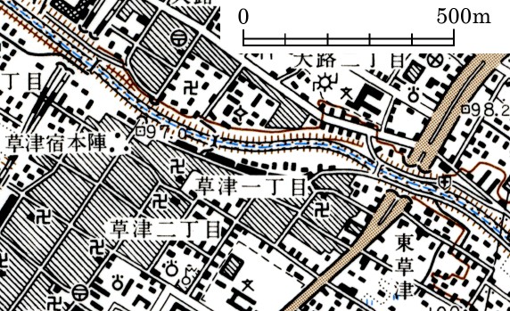
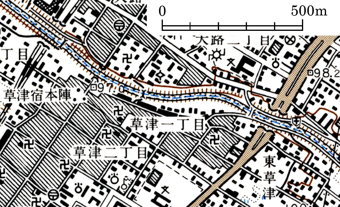
Corresponding Map
Laid-out sheet for print (Aerial Photograph and Map)
Notes
- Aerial Photograph:
- CKK-2000-1X C5-18,19 by GSI (May 2000)
- KK-2003-1X C14-19,20 by GSI (May 2003)
- Map:
- 1:25,000 Topographic Map "Kusatsu" by GSI (August 1998)
- Location:
- Kusatsu-shi, Shiga, Kinki, Honshu
- Topic on Topography:
- Raised Bed River
- Other Notes:
- See also Kusatsu River (1), that covers an wide area including this area.
- Kusatsu River was changed to the new channel (artificially excavated) in June 2002, then the raised bed channel in the central area of Kusatsu City has gone out of use.
|
Here are anaglyphs of some interesting topography in Japan. As teaching / studying materials for geography, you can freely download them, but use for other purpose except education is prohibited.
Service of some high-resolution images on the web are now suspended because of disk space of the server.
 You need red-blue (red-cyan) glasses to see anaglyph images.
- * NOTICE *
- For your eyes, please do not continue to look at anaglyph for long time.
When a teacher uses anaglyph in his class, he should cares about health of students.
- Credits
- Aerial photographs on this web site are reproduction of the aerial photographs taken by the Geographical Survey Institute, Japan with approval of the director general of GSI. (Approval Number: H17-so-fuku No.392)
- Maps on this web site are reproduction of 1:25,000 Topographic Map published by the Geographical Survey Institute, Japan with approval of the director general of GSI. (Approval Number: H17-so-fuku No.392)
