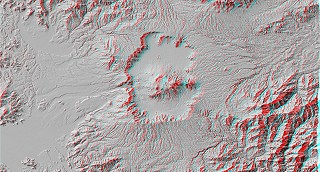
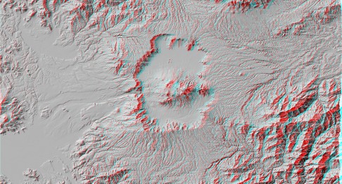
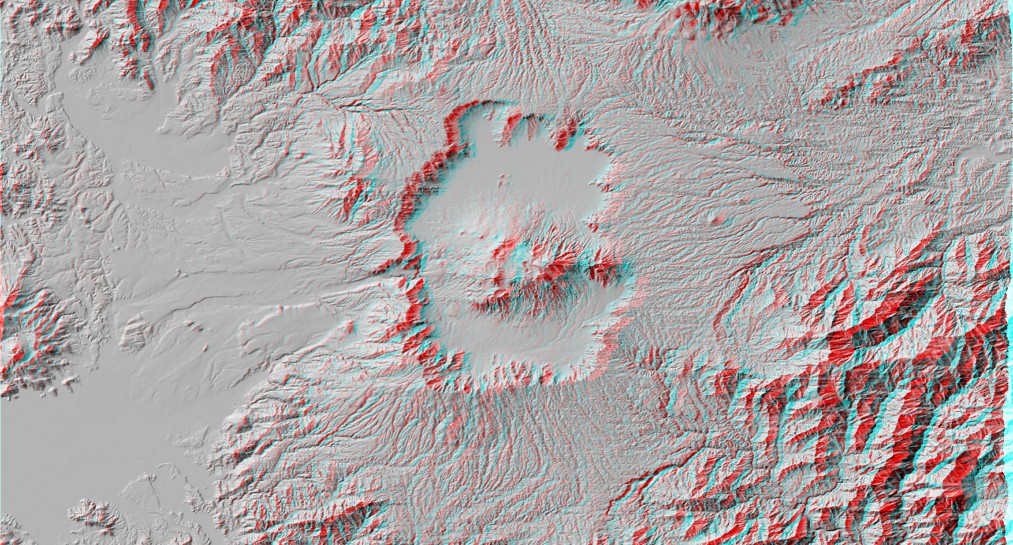
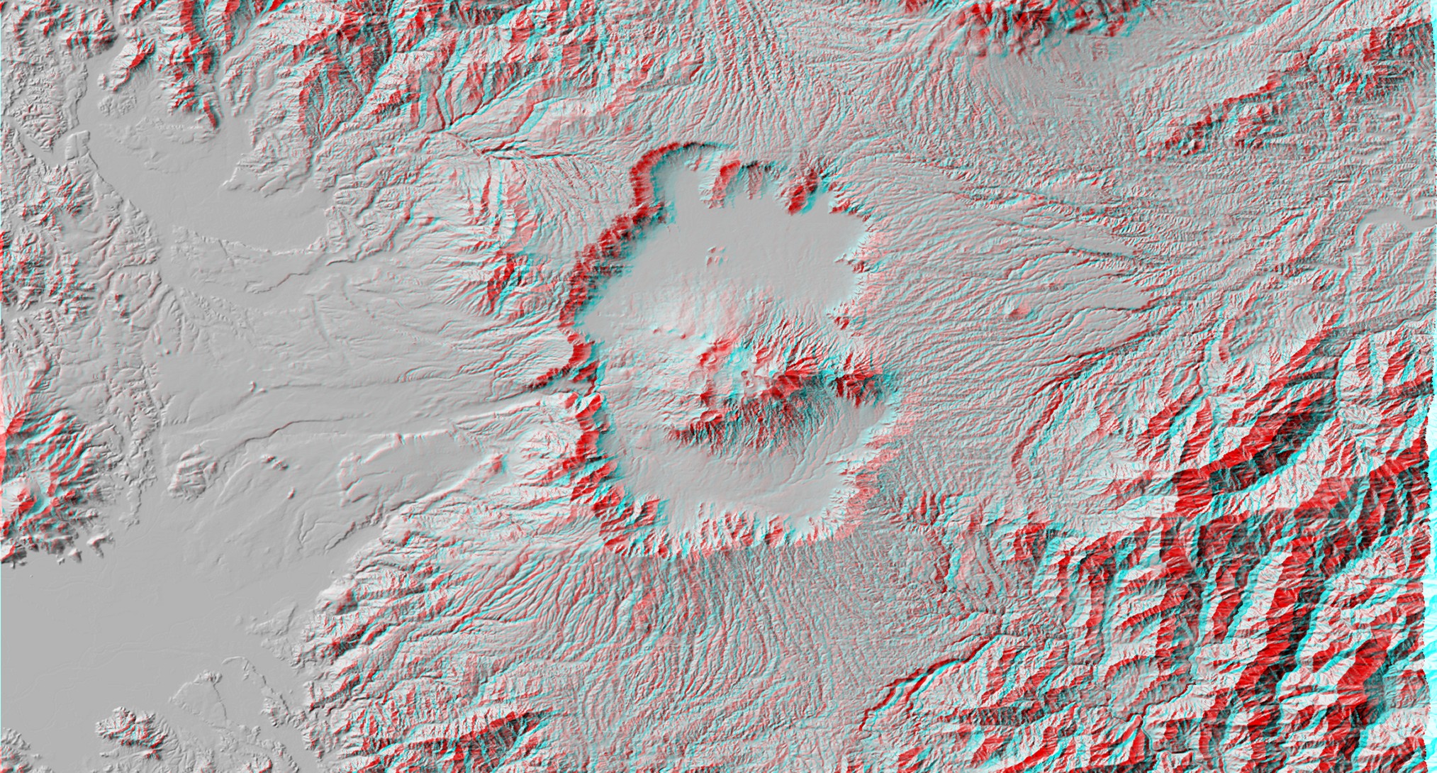
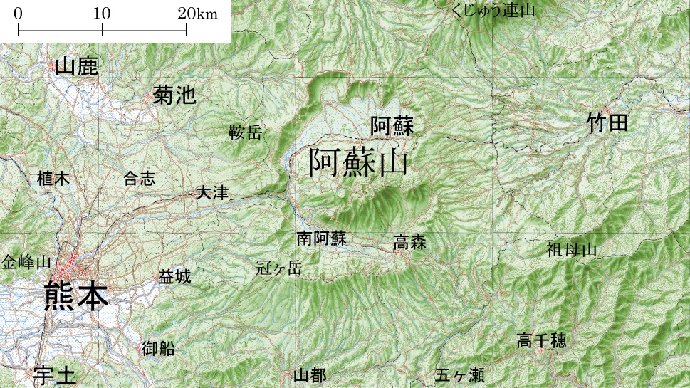
Aso Caldera
Shaded Relief Image (Anaglyph)
- 486x262pixels; JPEG; 66KB
- 1013x545pixels; JPEG; 286KB
- 2027x1090pixels; JPEG; 997KB
- 2027x1090pixels; TIFF; 5.06MB
Corresponding Map
- 1:500000 unofficially compiled map*; 72ppi; 465x262pixels; JPEG; 63KB
- 1:500000 unofficially compiled map*; 150ppi; 969x545pixels; JPEG; 284KB
- 1:500000 unofficially compiled map*; 300ppi; 1938x1090pixels; JPEG; 1.14MB
- 1:500000 unofficially compiled map* 300ppi; 1938x1090pixels; TIFF; 5.44MB
* These maps are unofficially compiled from "Digital Map 200000 (Map Image)", which is the digital image of 1:200,000 Regional Map.
Laid-out sheet for print (Shaded Relief Image and Map)
Notes
- Digital Elevation Data:
- "Digital Map 50m Grid (Elevation) NIPPON-III" by GSI
- Digital Map Image:
- "Digital Map 200000 (Map Image)" by GSI
- Map:
- 1:200,000 Regional Map "Kumamoto" by GSI
- 1:200,000 Regional Map "Oita" by GSI
- Location:
- Kumamoto, Kyushu
- Topic on Topography:
- Volcano, Caldera, Central Cone, Pyroclastic Flow Plateau
 You need red-blue (red-cyan) glasses to see anaglyph images.
